-
-
-
- Vintage
Shelby Maps
-
-

-
- Shelby
West Side
(left)
- 1884
-
- Sanborn
Mapearl
- iest
-
-
-
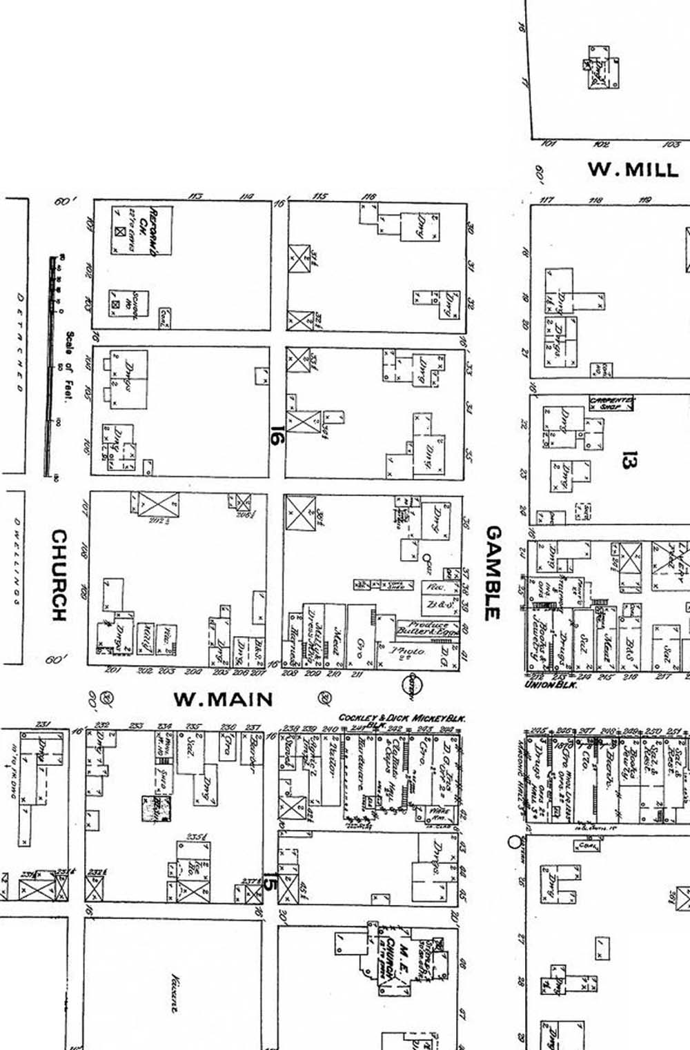
- This
map provides a much expanded view of the west side square
- which
was the Original Part of Shelby.
-
- The
Methodist church is in it's current location (directly above).
-
- A
drug store and grocery store are located on the southeast
- corner
of the square where the First National Bank is now located.
-
- There
is a photo studio on the northwest corner and a butter and
-
egg produce store just to the north.
-
- A
drug store and a books and jewelry store are located on
- the
Northeast corner in the Union Block building.
-
- The
southwest corner is the Mickey Block with a dry goods
- store
and a grocery as well as the Cockley & Dick building
- with
a hardware and a clothes store featuring hats and caps.
-
- Of
the streets listed, all are the same as in the present, except
- West
Mill Street which has been changed to Whitney ave.
-
-
-
-
-
-
-
- Copyright
© 2000 - 2004 Richland County - Shelby Chapter of The Ohio
Genealogy Society