-
-
-
- Vintage
Shelby Maps
-
-

-
-
- 1896
-Atlas
Map
-
- Shelby
- (West
Central)
-
-
-
- (Use the buttons
below to navigate along Main Street or move north or south.)


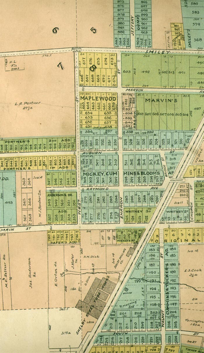
- Much
has been added to the area between Main Street and Smiley
- since
the previous map. The area south of Main Street and west of the
- C.
C. C. & St.L. (Cleveland, Columbus, Cincinnati, & St.Louis)
("The Big 4")
- Railroad
tracks is largely undeveloped at this time.
-
- The
Shelby Steel Tube Works plant faces southeastward with the
- office
on the opposite side of the tracks. Northward along the
- west
side of the tracks is the Shelby Milling Company and a
- coal
yard across the tracks.
-
- W

- Return
to Main Map Page.
-
-
-
-
-
- Copyright
© 2000 - 20018